GRI’s Drone Technology Takes Off
A field staff engineer stands near the bottom of a steep precipice, looking intently at their tablet they hold in front of them. With a few taps on the screen, there is a light whirring sound and a drone with multiple spinning rotors slowly approaches the ground in front of the engineer and lands with a small thud. Thankful that they did not have to scale that precipice through a rope-and-pulley system, the engineer packs up the drone and heads back to the office. Once downloaded from the cloud-based server on an office computer, a rendering is produced and comes into focus, presenting a bird’s-eye view of the precipice from an angle practically impossible to reach just through sheer manpower. The field staff engineer gets to work, identifying the sharp crescent shapes of recent landslide scarping on the hillside and jotting down notes for slope stabilization equations. Just in a single day, work that would normally take a few days on foot of work was completed with the assistance of the sleek company drone.
When it comes to drones, the most common industry terminology is Small Unmanned Aircraft (or Aerial) System, or sUAS for short. Specific vehicles within the sUAS are referred to as Unmanned Aerial Vehicles (UAVs), or drones. There is no exact pinpointed date when sUAS entered the geological field, but there are bathymetric and topographic survey records of river channels from 2007, and more frequent journalistic papers published around 2012 to 2014 regarding the use of sUAS imagery for seismic and geotechnical purposes. Since then, geotechnical sUAS services have expanded to include transportation and pavement surveying, flooding and disaster zone areas mapping, paleoseismology modeling, coastal and reef surveying, and even cave mapping, just to name a few. Each new advent of micro-UAV technology has led to accessibility of the geotechnical industry into better management of manpower, cost efficiency, and faster results/imagery production.
Most geotechnical sUAS’s fall within the civil and commercial category, although the research and development category produces drones that can be designed specifically for geotechnical surveying services. For GRI specifically, we use a commercial-model DJI Mavic 2 Pro drone equipped with a Hasselblad camera and camera sensor. This camera is well known for its low-light capabilities and adjustable aperture, creating more flexibility when grading terrains and detailing raw images. From a geotechnical perspective, this drone is easy to learn the controls of, lightweight, portable, and creates high-resolution images and videos. Other drones on the market include commercial-grade devices that are heavier but can support dual-sensor radiometric/non-radiometric thermal cameras, such as those from FLIR, DJI, or Vuneec. These drones can include octo-copter configurations for increased stabilization, fully autonomous fixed-wing mechanisms for pre-planned flight patterns, anti-collision beacons, and waterproof/dustproof designs.
The sUAS consists largely of two processes: data collection and processing. The most common programs used for drone mapping are a mission-planning software and a photogrammetric software. Pix4DCapture, a free drone flight-planning application created by Pix4D based out of Switzerland, enables the ability to plan a flight and define its parameters (e.g., altitude, image overlap and speed, and setting automatic image-gathering intervals) through a mobile interface. The media captured by the UAV are then uploaded into a cloud database for ease of transferring and importing.
The gathered media are then imported into photogrammetric software for use in geographic information system (GIS) applications, visual effects production, and indirect measurements of objects in different scales. Agisoft Metashape provides 3D reconstruction and rendering services by constructing 3D environments from still imagery collected by the drone. From there, 2D, dimensionally accurate orthomosaics and point-cloud scenes can be constructed and rendered for use in project applications and development of recommendations and supporting figures for client documentation.
The two highlighted software programs are only a miniscule sampling of the available software applications to a drone user in the geotechnical industry. Each software offers its own advantages for project characteristics and production of representative deliverables, so researching beforehand is highly recommended when selecting specific programs to use for geotechnical projects.
GRI currently uses sUAS services for pavement- and geology-related projects within Oregon and Washington, especially in conditions that are too physically hazardous for field engineers to safely inspect site conditions. Blaine Wruck, EIT, handles sUAS surveying for primarily pavement distress surveys. These surveys are part of the design process for pavement rehabilitation included in the 1993 American Association of State Highway and Transportation Officials Guide for Design of Pavement Structures, and are used to visually capture attributes of the pavement in live-traffic areas from a straight-down camera angle, therefore generating higher-quality images at a ground scale for review and mapping in the office. “Since this task is often performed under live traffic [conditions],” says Wruck, “the drone has proven to be an indispensable tool for performing this task, as it allows our team to review the pavement distresses in the office, and also takes our field staff out of harm’s way.”
One of our pavement-related projects where drone services are used is the transportation engineering services project for the City of Springfield, Oregon. For this project, we piloted sUAS technology to capture aerial imagery of multiple busy street segments in Springfield, generating a high-resolution, georeferenced orthomosaic that was spatially accurate and contiguous of the highlighted street segments. We then used the orthomosaic to identify areas of the alignments where load-related cracking is visible and where approximate areas of distress are, leading to localized repair recommendations such as full-depth repair or partial-depth reconstruction of the existing asphalt concrete or portland cement concrete pavements.
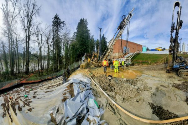
Aside from the benefit of maintaining safety for field staff, using sUAS technology to document site conditions for geologic hazard evaluations has similar benefits. In many cases, these hazards pertain to areas with steep slopes that would normally require a field staff member to be physically suspended for collecting slope data and information regarding potential hazards and remediation strategies. Drones resolve this potentially unsafe issue, allowing the field staff member to record the data remotely while maneuvering the drone through the site. The drone’s agility also enables it to access previously inaccessible areas, including volcanic zones with gas-emission levels too toxic for humans, or cave systems too complex or small for a human to spelunk (Jordan, 2015).
An example of one of our notable geologic hazard projects that used sUAS technology is our work for the Oregon State University (OSU) – Cascades campus in Bend, Oregon. The location of proposed building and associated structures lies within a fault zone that was previously operated as a pumice mine, so OSU commissioned GRI to conduct seismic and geotechnical analyses of the site. With our drone device, we mapped the fault lines with our drone and rendered the data into a 3D model to create a scaled, accurate image of the site, which allowed us to document the elevations, soil layering of the displaced fault, and site conditions at the time of surveying (the 3D photo can be viewed here: https://www.voxxlr.com/s/1561427584932).
The extent of UAS technology development over the past decades is consistently keeping the door open to the question of: Where are these services heading for the future? Well, there is no specific answer to this question. “It is my opinion that the [architectural and engineering] industry is yet to realize the full potential of drones,” writes Wruck. “Most proponent sUAS technology is creative and forward-thinking, which translates into new-use cases being developed and implemented regularly. The sUAS industry is still very much in its infancy…” Even if there is still a lot to be revealed with sUAS’s, many industry professionals realize how game-changing this sector is, and are focusing discussion topics on it at engineering conferences. With sUAS machine-learning and hardware support capabilities, only the surface of capabilities has been touched by the geotechnical industry. As outlined in the 2015 article by B. R. Jordan, potential modifications to UAV devices can contribute to the collection of other data, including thermal imaging, ambient weather mapping, long-term aerial monitoring, sample collection, vertical outcrop imaging, gas measurements, and further mapping and surveying data methods. However, where there are a multitude of possibilities for sUAS technology, comes significant challenges that must be mitigated.
The main challenges when it comes to development of sUAS technology can be divided into three categories: natural, technological, and legal. The natural category includes hazardous conditions imposed by weather, such as high winds and extreme precipitation events. Drones are designed to be mostly waterproof and can maintain stability with light winds, but extreme conditions can throw a drone off course, damage equipment, or even cause the drone to crash or travel into areas of non-recovery. The technological category includes drone-specific items, such as battery power, lens distortion, or difficulty determining the scale of view. Most commercial-grade drones run on approximately 30 minutes of battery usage, which can be dramatically reduced when faced with natural challenges that require more power to control the UAV. The last category concerns the legal grey area of governmental regulation. As Jordan summarized (Jordan, 2015), drones have led to wildlife aggravation, natural features disturbance, potential collisions with planes, and privacy concerns.
Certification courses and educational/training opportunities for any individual using the sUAS is key to mitigating the abovementioned challenges. Additionally, the Federal Aviation Administration (FAA) published multiple guidelines for navigating open air in rural and non-rural areas that are updated often as new information is released. Most drone operators can register their drone and abide by FAA airspace restriction rules, but operators using sUAS for commercial purposes or more have to review FAA Part 107 guidelines, complete a knowledge test to become an FAA-certified drone pilot, and register their drone.
sUAS services are becoming increasingly popular and allowing innovative ways of observing and recording data on site conditions to be developed within the architectural and engineering industry, particularly in the geotechnical realm. Not only are drones cost-effective in reducing field staff time to nearly half, but documentation and imagery provided to clientele are higher quality, and data gathering is much safer in hazardous conditions. With the constant research and development of sUAS, it is exciting to see the technology behind the service reach new heights for the future.
References
American Association of State Highway and Transportation Officials, 1993, Guide for Design of Pavement Structures.
DJI Official, Mavic 2 – DJI, accessed May 22, 2021, https://www.dji.com/mavic-2.
Federal Aviation Administration, 2021, Certificated Remote Pilots including Commercial Operators, https://www.faa.gov/uas/commercial_operators/.
García, G., Hugo, A., Prieto, R., and Abello, S., 2017, Evaluation and Monitoring of Geotechnical Hazards Using UAV Based Digital Photogrammetry: Proceedings of the ASME 2017 International Pipeline Geotechnical Conference. ASME 2017 International Pipeline Geotechnical Conference. Lima, Peru, V001T03A002, ASME.
GRI, 2019, Pavement Report, Parts I-V, prepared for OBEC Consulting Engineers.
Jordan, B. R., 2015, A Bird’s-Eye View of Geology: The Use of Micro-Drones/UAVs in Geologic Fieldwork and Education: Geological Society of America Today, vol. 25, no. 7.
Pix4D, 2021, Pix4Dcapture: Pix4D, version 4.7.1, April 22, 2021. https://www.pix4d.com/product/pix4dcapture.
Sayler, K., 2015, A World of Proliferated Drones: A Technology Primer: Center for a New American Security.
UAV Coach, 2021, The 14 Best Drones for Professional and Commercial Drone Pilots, March 29, 2021, https://uavcoach.com/professional-drones/#guide-1.