Mike Marshall, CEG, to Present at the AEG Annual Meeting
Mike will be giving a presentation on the geologic characterization and landslide hazard assessment of the Oregon Coast Range transmission line. If you are attending the meeting, this presentation will be a part of Technical Session #7 this Thursday at 8:40am. Below is a synopsis of the presentation:
Geologic Route Characterization and Landslide Hazard Assessment of
Oregon Coast Range Power Transmission Line
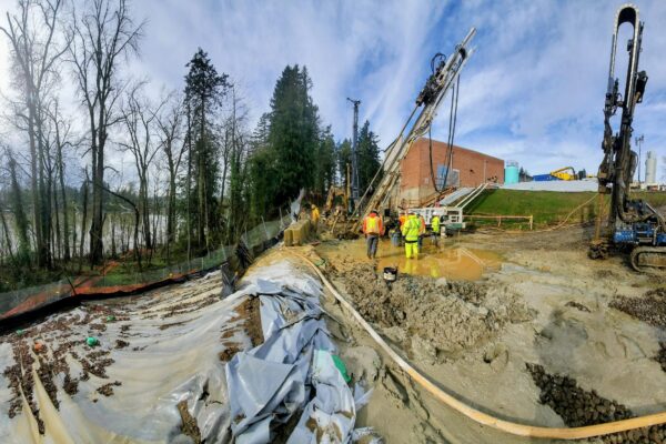
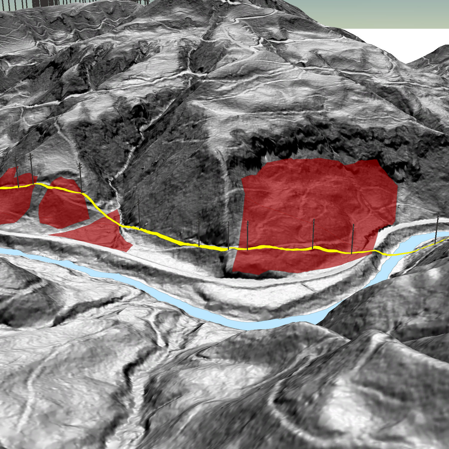 The Bonneville Power Administration (BPA) elected to replace an aging 115-kV power transmission line in the Oregon Coast Range, which is a belt of uplifted sedimentary and volcanic rocks near the Pacific Ocean. A geologic route characterization and landslide hazard assessment were conducted to characterize and map landslides and identify areas of potential slope instability that could damage transmission structures. The type and occurrence of landslides were evaluated using information gathered through review of geologic maps and literature, aerial photography, Statewide Landslide Database for Oregon (SLIDO), and lidar data. Landslides identified from literature and remotely sensed data were cataloged in GIS, and a surface reconnaissance was conducted by GRI. A total of 76 structures were located in areas identified as landslide topography. Ground cracks indicative of slope movement were observed at nine structures, and four locations were identified with loose guy wires during the surface reconnaissance. Each of the 331 structures assessed were assigned a hazard rating based on documented or observed landslide features, indications of recent mass movement, and/or observed ground cracks. Structures were rated from high to low risk for the prioritization of mitigation efforts. Of the 331 structures assessed, 12 structures were identified as having a high risk for future slope instability. All but three of the high-risk structures appeared to be associated with sidecast fill placed as part of access roads and structure work pad construction. In general, the slope instability associated with the roads and bench areas appeared to be the result of oversteepened, loose sidecast fill placed on steep natural slopes or steep cut slopes.
For more information regarding the Annual Meeting, please visit: http://www.aegweb.org/